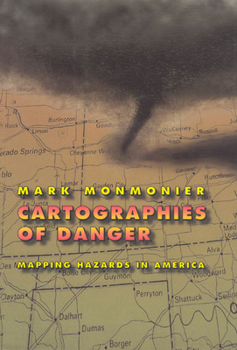
Cartographies of Danger: Mapping Hazards in America
Select Format
Select Condition 
Book Overview
No place is perfectly safe, but some places are more dangerous than others. Whether we live on a floodplain or in "Tornado Alley," near a nuclear facility or in a neighborhood poorly lit at night, we all co-exist uneasily with natural and man-made hazards. As Mark Monmonier shows in this entertaining and immensely informative book, maps can tell us a lot about where we can anticipate certain hazards, but they can also be dangerously misleading. California, for example, takes earthquakes seriously, with a comprehensive program of seismic mapping, whereas Washington has been comparatively lax about earthquakes in Puget Sound. But as the Northridge earthquake in January 1994 demonstrated all too clearly to Californians, even reliable seismic-hazard maps can deceive anyone who misinterprets "known fault-lines" as the only places vulnerable to earthquakes. Important as it is to predict and prepare for catastrophic natural hazards, more subtle and persistent phenomena such as pollution and crime also pose serious dangers that we have to cope with on a daily basis. Hazard-zone maps highlight these more insidious hazards and raise awareness about them among planners, local officials, and the public. With the help of many maps illustrating examples from all corners of the United States, Monmonier demonstrates how hazard mapping reflects not just scientific understanding of hazards but also perceptions of risk and how risk can be reduced. Whether you live on a faultline or a coastline, near a toxic waste dump or an EMF-generating power line, you ignore this book's plain-language advice on geographic hazards and how to avoid them at your own peril. "No one should buy a home, rent an apartment, or even drink the local water without having read this fascinating cartographic alert on the dangers that lurk in our everyday lives. . . . Who has not asked where it is safe to live? Cartographies of Danger provides the answer."--H. J. de Blij, NBC News "Even if you're not interested in maps, you're almost certainly interested in hazards. And this book is one of the best places I've seen to learn about them in a highly entertaining and informative fashion."--John Casti, New Scientist
Format:Hardcover
Language:English
ISBN:0226534189
ISBN13:9780226534183
Release Date:May 1997
Publisher:University of Chicago Press
Length:378 Pages
Weight:1.55 lbs.
Dimensions:1.0" x 6.0" x 9.0"
Customer Reviews
4 ratings
DO MAPS TELL ALL
Published by Thriftbooks.com User , 18 years ago
I wouldn't describe this book as one that "I couldn't put down" as they say, but it made some interesting points. Maps of dangerous areas can mislead, for example, by giving the impression that a danger is especially great in one area because it is concentrated there, even though it may actually be worse elsewhere where population density is greater. Readers may also overreact to obvious and publicized hazards, such as a power plant, while ignoring more common threats such as auto accidents. Anyone who likes maps or uses them extensively for information will get something from this publication.
Great Book about Emergency Planning
Published by Thriftbooks.com User , 20 years ago
I use this book as additional reading for my Technology in Emergency Management course. This is a great book connecting mapping, hazards, and technology. It is written so non-technical types, like me, can understand. If you are interested in disasters, hazards, vulnerability assessments, or familiar with CAMEO, ALOHA, FEMA and NRC, etc. this book should be on your bookshelf.
Check this out if you like Edward Tufte (Envisioning Info.)
Published by Thriftbooks.com User , 24 years ago
A great overview of how to convey information through cartography. The author chooses to focus on mapping environmental hazards to demonstrate this; their may be other topics that would lend itself to the exercise but the chosen subject seems a perfect fit. Entertaining and accessible.
A useful tool for evaluating environmental risk.
Published by Thriftbooks.com User , 27 years ago
Monmonier, a professor of geography at Syracuse University, discusses the art and science of hazard-zone mapping, "a momentous adaptation of electronics and numerical analysis", in this clearly-written explanation of the possibilities and limitations of the new cartographic genre. Assuming no special cartographic knowledge on the part of the reader, the author begins with the basics of scale in map-making, and proceeds to explore the ways in which tornadoes, earthquakes, environmental pollution hazards, crime, and other risks are analyzed and translated into usable graphical form. Noting that "it is wise to question the map maker's motives", Monmonier also encourages the reader to view risk-maps with some healthy skepticism as "partly rhetorical,,,social constructions" which "can always be manipulated". With numerous charts, graphs, and maps, Monmonier's work is highly recommended as a clear exposition of geographic hazards and a useful tool for evaluating one's own level of risk. (The "score" rating is an ineradicable feature of the page. This reviewer does not "score" books.)


