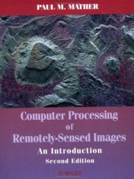
Computer Processing of Remotely-Sensed Images: An Introduction
Computer Processing of Remotely-Sensed Images An Introduction Second Edition Paul M. Mather School of Geography, The University of Nottingham, UK Remotely-sensed images of the Earth's surface provide an invaluable source of information about the geographical distribution of natural and cultural features, as well as a record of changes in environmental conditions over decadal time-scales. The second edition of this successful book provides an accessible introduction to the processing and analysis of digital images collected by aircraft and satellite-borne sensors that operate in the visible, infrared and microwave regions of the spectrum. The book begins with a survey of the physical principles of remote sensing, and goes on to consider the nature and sources of remotely-sensed data. A short survey of those aspects of computing that are relevant to remote sensing completes the introductory section of the book. In the remaining five chapters, the author surveys those aspects of image processing and pattern recognition that are relevant to remote sensing applications, including: pre-processing, enhancement, image transforms, and filtering techniques. An extended survey of classification and related methods, including neural networks, fuzzy classifiers and spectral unmixing, forms the final chapter. A unique feature of this book is the provision of a CD-ROM containing software and image data sets. The MIPS image display program provides facilities for image display, enhancement, filtering, classification, and arithmetic. 38 additional programs are provided, convering applications including maximum likelihood classification, spectral unmixing, geometric correction, principal components analysis. All of these programs run on a standard PC using the Windows 95 operating system. In addition, more than 25 image data sets collected by the Landsat MSS and TM, SPOT HRV, NOAA AVHRR and RADARSAT SAR are contained on the CD-ROM, making this book a complete package - textbook, software and data - for advanced undergraduate and Masters courses. It can also be used by postgraduate research students as a survival guide.
Format:Paperback
Language:English
ISBN:0471985503
ISBN13:9780471985501
Release Date:June 1999
Publisher:Wiley
Length:306 Pages
Weight:1.40 lbs.
Dimensions:0.8" x 7.5" x 9.7"
Related Subjects
Computer Science Computer Technology Computers Computers & Technology Earth Sciences Engineering Geography Geology GIS Graphics & Multimedia Graphics & Visualization Methodology Programming Regional Science Science & Math Science & Scientists Science & Technology Software Engineering TechnologyCustomer Reviews
0 rating


