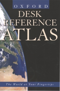
Desk Reference Atlas
Boasting many of the same features as Oxford's acclaimed Atlas of the World, the thoroughly up-to-date, comprehensive, and authoritative Desk Reference Atlas offers exceptional map quality in a handy, easy-to-use format.
Elegant digitally produced maps are drawn from the latest available sources, including satellite feeds and the most recent surveys and censuses. The comprehensive maps reflect changes in boundaries and place names all over the world. A colorfully illustrated 32-page thematic section covers timely topics ranging from the solar system, volcanoes, and earthquakes to international organizations, climate, and agriculture, and features useful statistics for countries around the world. A comprehensive 17,000-entry alphanumeric index adds to the usability of this volume, allowing quick and ready reference to any point in the world.
Desk Reference Atlas's convenient form and affordable price make it ideal for quick reference at home, in school, or at the office. No desk should be without it.
Format:Hardcover
Language:English
ISBN:0195217926
ISBN13:9780195217926
Release Date:August 2001
Publisher:Oxford University Press, USA
Length:176 Pages
Weight:1.45 lbs.
Dimensions:0.8" x 6.5" x 9.6"
Customer Reviews
2 ratings
Just right ...
Published by Thriftbooks.com User , 16 years ago
At a great price, this atlas is just right for finding places quickly and easily. Maps are good. Color is well done. It is easy on the eyes. The atlas is very portable and takes up little space on desktop or shelf. Keep it handy.
Highly portable.
Published by Thriftbooks.com User , 24 years ago
A very portable concise world atlas by George Philip is a scaled-down version of the Great World Atlas by the same publisher. The atlas starts with a statistical section, followed by a very good thematic section, called "the world in focus". These attractive pages include photos, graphs, maps, and explanatory text. A section on world flags precede the reference maps, which, too, are scaled down from the larger Philip's atlases. Surface height is indicated by relief coloring (which is rather saturated), but the gray-shading has been omitted here, adding to the legibility of the maps. There is a well-balanced coverage of the world, with Europe and North America getting about the same percentage of maps. The maps are not too accurate, and while some of them show detailed information, others remain quite empty. There is a very basic index-gazetteer of 17,000 names, which is a bit less than most of its competitors of this class. Since there are no urban area maps of the most populous regions, may suburb cities are not included, which is one of the main minor points of this desktop size atlas. For office use, it will probably suffice most of the time, but I would use it sooner for educational purposes, even for children. For serious world news following, there are certainly better alternatives. But all in all this release can certainly compete with other atlases in its class, especially because of the high quality thematic section.


