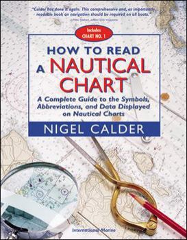
How to Read a Nautical Chart: A Complete Guide to the Symbols, Abbreviations, and Data Displayed on Nautical Charts
Select Format
Select Condition 
Book Overview
Authoritative, practical, and hands-on information on reading and relying on electronic and paper nautical charts The classic How to Read a Nautical Chart explains every aspect of electronic and paper... This description may be from another edition of this product.
Format:Paperback
Language:English
ISBN:0071376151
ISBN13:9780071376150
Release Date:August 2002
Publisher:International Marine Publishing
Length:237 Pages
Weight:1.52 lbs.
Dimensions:0.4" x 8.6" x 10.8"
Customer Reviews
5 ratings
Navigation for the person willing to study and really understand
Published by Thriftbooks.com User , 16 years ago
Very detailed. Plan to sit with coffee and really study but you will get good understanding of the material.
The legend on a nautical chart is not enough
Published by Thriftbooks.com User , 17 years ago
As a newbie to reading charts I soon realized that much of the information displayed on a nautical chart is difficult or imposable to decode without some reference outside of the chart itself. This book does a beautiful job of explaining all the mysterious symbols and conventions. It also has a great introduction that puts chart creation and interpretation into a practical, real-world perspective. I would consider this book to be a vital part of any vessel's safety equipment.
"What does 'rky' mean? Oops!"
Published by Thriftbooks.com User , 18 years ago
Since the current U.S. Administration saw fit to cease publication of CHART NO. 1, the government's own guide to reading maritime maps, back in 2000 (maybe they figured Dubai might pick up the slack around our harbors), HOW TO READ A NAUTICAL CHART is an absolutely crucial educational volume for those of us new to reading charts. It's all here. Nigel Calder does a splendid job of taking the esoterica of chart symbolism and language and turning it into something any boater can understand in everyday terms. He also does a fine job delineating the differences between harbor charts, large area charts, GPS readings and so on, all of which have their own internal but non-complimentary logic. If you leave the dock, knowledge of and familiarity with charts can avoid costly errors, save your boat, and literally save your life. HOW TO READ A NAUTICAL CHART is a reference you must have.
Fascinating book
Published by Thriftbooks.com User , 19 years ago
I picked it up expecting a summary of the symbols in nautical charts and wondering why on earth anyone would write a book on such a simple subject. What this book actually does is show why your charts might be completely inaccurate compared to GPS information and what you can do about it. It's something nobody who depends on the information in charts should be without. It's also highly technical material and although the author's explanations are lucid and clear, it's inherently not the easiest book to read. But the information there is crucial, especially if you're planning to rely on GPS navigation and electronic charts. The bottom line message is that many charts do not use the same way of mapping the earth as your GPS, and so navigational hazards placed on the charts may not precisely line up with information plotted off a GPS. This is particularly hazardous when you have an integrated GPS/chart plotter, which makes it appear that everything's precisely in sync. In addition, much of the information on charts as created by chart makers is not as accurately positioned as a GPS might make you think. Many charts are quite inaccurate compared to GPS. This is important stuff and it should be emphasized that not understanding this fully and blindly relying on electronics may cause you to lose your boat. I think it's well worth defending this book from other reviewers, who clearly didn't take the time to understand the arguments laid out so carefully by the author. For coastal cruisers who only go out in good weather, this book is probably overkill. But if you're doing long-distance cruising, these arguments could save your boat.
Clear and in-depth
Published by Thriftbooks.com User , 19 years ago
I am sorry that previous reviewers, who really wanted something a lot less that this book offers, have chosen to diss this book because it offers so much. I once picked up a copy of a Henry James novel to take along as a light read on a camping trip. A mistake. But I would not criticize James for not meeting my more limited need. It was my mistake. Anyway, Calder's book is excellent and provides wonderful insight into the difficulties of making charts, and of reading them. Especially insightful on the dangers and values of chartplotters. I consider this an excellent resource for people who really want to understand all that a chart can tell them and also its limits. Excellent, excellent, excellent!


