
Newcastle Upon Tyne A-Z Premier Map
No Customer Reviews

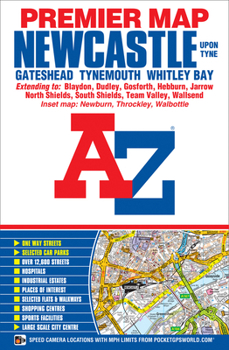
This A-Z Premier Map of Newcastle Upon Tyne is a full colour, single sided street map covering an area extending to:*Dinnington*Seaton Burn*Dudley (part)*Whitley Bay*Tynemouth*South Shields*Castletown (part)*Washington (part)*Sunniside*Blaydon*West Denton*Newcastle International AirportAlso included:* inset map of Throckley and Newburn* Large scale city centre map of Newcastle Upon TynePostcode districts, one-way streets and safety camera locations with speed limits are featured on the maps.An index booklet, listing streets, selected flats, walkways and places of interest, places and area names, National Rail and Metro stations, is attached to the inside of the cover. Also included is a separate list of hospitals and hospices covered by this map.
Format:Paperback
Language:English
ISBN:1782570888
ISBN13:9781782570882
Release Date:August 2015
Publisher:Geographers' A-Z Map Company Ltd.
Length:1 Pages
Related Subjects
TravelCustomer Reviews
0 rating
Copyright © 2025 Thriftbooks.com
Terms of Use | Privacy Policy | Do Not Sell/Share My Personal Information | Cookie Policy | Cookie Preferences | Accessibility Statement
ThriftBooks ® and the ThriftBooks ® logo are registered trademarks of Thrift Books Global, LLC
ThriftBooks ® and the ThriftBooks ® logo are registered trademarks of Thrift Books Global, LLC
