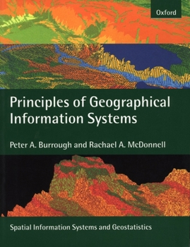
Principles of Geographical Information Systems
Select Format
Select Condition 
Book Overview
This book is a completely new version of the highly successful Principles of Geographical Information Systems for Land Resources Assessment which was first published in 1986. GIS are not just used for electronic map-making but today are major tools for the management of our physical and social environment. GIS are used to assist political decisions and play a part in market research, in the management of utility services, in automated navigation systems and in many other fields. This book presents a strong theoretical basis for GIS, which is often lacking in other texts. Spatial data are usually based on two, dichotomous paradigms, exactly defined entities in space, such as land parcels, or the continuous variation of single attributes, such as temperature or rainfall. Methods for modelling both kinds of phenomena and storing them in spatial databases are described in detail, including the use of geostatistics for interpolating from points to continuous fields. Examples of how spatial data and an analysis of their spatial interactions are used to solve a wide range of practical problems ranging from site-location analysis through land degradation, the optimizing of timber extraction from forests and the redistribution of Chernobyl radioactivity by floods are explained clearly and in detail. Much attention is paid to the problems of data quality and how statistical errors in spatial data can affect the results of spatial modelling based on the two paradigms of space. Fuzzy logic and continuous classification methods are presented as methods for linking the two spatial paradigms. The book concludes with an investigation of current developments in providing spatial data for the whole world over the Internet. As such the new volume provides a comprehensive and concise introduction to the theory and practice of Geographical Information Systems (GIS). Targeted at undergraduates, graduates, and professionals in disciplines such as physical and human geography, hydrology, geology, environmental science, cartography, epidemiology, radioecology, agriculture, spatial planning, land tenure, and land evaluation the book explains why spatial data and the information systems based on them are important in the modern world.
Format:Paperback
Language:English
ISBN:0198233655
ISBN13:9780198233657
Release Date:April 1998
Publisher:Oxford University Press, USA
Length:352 Pages
Weight:0.05 lbs.
Dimensions:0.9" x 9.6" x 7.4"
Customer Reviews
4 ratings
Comprehensive, Thorough and Clear
Published by Thriftbooks.com User , 21 years ago
I'm currently a student in a GIS program. This is the required text for one of my courses this session. My previous session I used the Heywood book and I found it dated and out of touch and dull. I much prefer this one. While it is very detailed, I appreciate the more comprehensive explanations of how things actually work behind the scenes. Managing data is one of the most crucial aspects of GIS and having a broader overview is proving most helpful. It is written in a formal, rather "dense" style, but I didn't find the British English to be much of a hindrance. I'm actually quite tired of books that "fluff" over topics and talk down to the audience by giving overly simple explanations.
Good book for all GIS users
Published by Thriftbooks.com User , 22 years ago
This is one of the best texts currently available on the topic of GIS. It gives an overall perspective of GIS to any level of user, from the basic to the advanced. After being educated in the American system (BS, Geography, United States Military Academy) and the British system (MSc, GIS, Cranfield University and U.K. Army Survey Course) I found this book to be the most unbiased and easy to follow GIS text on the market. In fact, I am recommending it to be the reference text for the GIS curriculum at NIMA's National Geospatial Intelligence School. This book remains true to its aim: "To provide an introduction to the theoretical and technical principles that need to be understood to work effectively and critically with GIS." It is neither a geography text nor an earth science text, so those involved in that educational environment should choose another book.
Very Good book.
Published by Thriftbooks.com User , 23 years ago
I checked out this book from the library for reference and decided to get a personal copy of the same book. This is probably one of the best books that one can get for GIS introduction. Other books do not talk as much about the specifics of the spatial data and its nuances. They are busy selling the applications of GIS (geographic information systems) to their domain.Good luck.
An essential introduction to GIS
Published by Thriftbooks.com User , 24 years ago
This is arguably the best introduction to GIS available. A worthy successor to Burrough's earlier work, this book provides a very broad perspective of spatial information systems, ranging from the basics of data modelling and representation, to more complex (but essential) issues such as geostatistics, fuzzy logic and data quality. A lot of so-called "introduction to GIS" books are in reality books about one commercial product. Not this one. Many books only cover the very basics, and thus narrow the reader's perspective. This book will open your mind about many aspects of GIS, since it provides a very rich perspective of the field. I have been using this book in my graduate courses on GIS, with excellent results.


