
West Midlands A-Z Street Atlas (Spiral)
No Customer Reviews

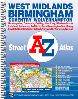
This spiral bound map of Birmingham and the West Midlands includes coverage of:*Birmingham*Coventry*Dudley*Solihull*Stourbridge*Walsall*WolverhamptonThe atlas includes 222 street map pages which extends to include:*Cannock*Lichfield*Tamworth*Atherstone*Nuneaton*Hinckley*Rugby*Royal Leamington Spa*Warwick*Kenilworth*Redditch*Bromsgrove*KidderminsterAlso included are large scale city centre maps of Birmingham, Coventry and Wolverhampton and a West Midlands rail and Midland Metro transport connections map.Postcode districts, one-way streets and safety camera locations with maximum speeds are featured on the street mapping.The index section lists streets; selected flats, walkways and places of interest; place and area names; National Rail and Midland Metro stations. There is a separate list of hospitals, NHS Walk-in Centres and hospices covered by this map.
Format:Spiral-bound
Language:English
ISBN:1782570942
ISBN13:9781782570943
Release Date:September 2015
Publisher:Geographers' A-Z Map Company Ltd.
Length:320 Pages
Related Subjects
TravelCustomer Reviews
0 rating
Copyright © 2025 Thriftbooks.com
Terms of Use | Privacy Policy | Do Not Sell/Share My Personal Information | Cookie Policy | Cookie Preferences | Accessibility Statement
ThriftBooks ® and the ThriftBooks ® logo are registered trademarks of Thrift Books Global, LLC
ThriftBooks ® and the ThriftBooks ® logo are registered trademarks of Thrift Books Global, LLC
